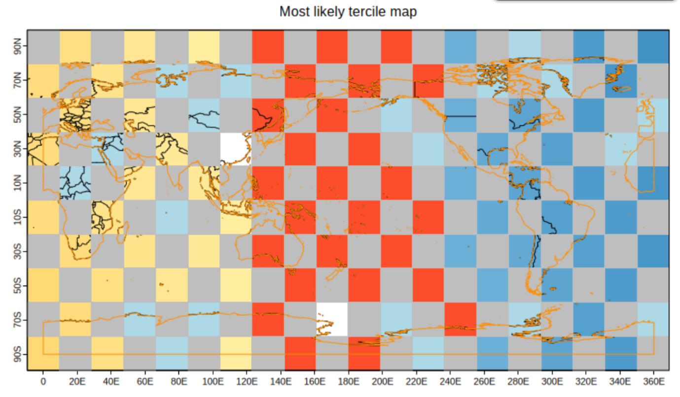
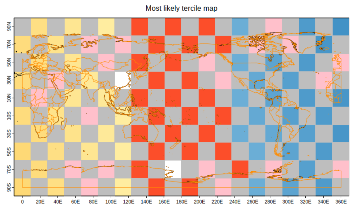
This MR is to implement in the SUNSET repo the fix for issue esviz#24 (closed) regarding the country borders being overlapped. As stated in the esviz MR:
The issue came from how VizCombinedMap() applied the mask after calling VizEquiMap() and re-plotted over it the coastlines but not the country borders. As a result, when a mask was present, the country borders undermeath it were not visible.
This fix ensures that, if a mask is used, the country borders are drawn in VizCombinedMask() after applying the mask. As discussed with @vagudets, when this is the case, I've made VizEquiMap() skip drawing the country borders so they can directly be drawn by VizCombinedMap() and not be drawn twice.
In test images below, the gray areas represent the mask (applied in VizCombinedMap() after calling VizEquiMap()), and the orange lines show what is redrawn afterward:
- Left image (before): only the coastlines are being redrawn and the country borders are covered up by the mask.
- Right image (after): both coastlines and country borders are redrawn over the mask.

There is a separate issue with the maps not lining up correctly at the left and right edges. I will address this in a different development.
Best,
Ariadna